ABOUT OUR FIRM
Our Qualifications
Cascadia Geoservices, Inc. is a locally owned and operated Pacific Northwest-based geological, geotechnical, and geo environmental consulting firm with regional offices in southern Oregon and southern Washington. We are a dedicated group of geologists and engineers who know local soil, groundwater, and geological conditions typically encountered while building in Oregon and Washington. We are a local, closely managed firm, and take pride in our work and in our competitive professional fees. Our local expertise comes from having lived, attended college, and worked in the Pacific Northwest since the early 1980s.
Our current client list includes Oregon and Washington property owners, contractors, architectural and engineering firms, private developers, attorneys, and regional utility companies. We are well versed in Pacific Northwest building and seismic codes and have worked successfully with local, county, and state of Oregon and Washington officials in identifying geological, geotechnical, and geo environmental permitting and planning issues.
Cascadia Geoservices, Inc., provides geological, geotechnical and geoenvironmental services exclusively to our Oregon and Washington clients. Cascadia Geoservices, Inc. has worked extensively as an on-site representative during construction. Our site observation services result in detailed daily observation reports to our client.
Our Qualifications
Cascadia Geoservices, Inc. is a locally owned and operated Pacific Northwest-based geological, geotechnical and geo-environmental consulting firm with regional offices in southern Oregon and southern Washington. We are a dedicated group of geologists and engineers who know local soil, groundwater and geological conditions typically encountered while building in Oregon and Washington. We are a local, closely managed firm, and take pride in our work and in our competitive professional fees. Our local expertise comes from having lived, attended college and worked in the Pacific Northwest since the early 1980’s.
Our current client list includes Oregon and Washington property owners, contractors, architectural and engineering firms, private developers, attorneys and regional utility companies. We are well versed in Pacific Northwest building and seismic codes and have worked successfully with local, county and state of Oregon and Washington officials in identifying geological, geotechnical and geoenvironmental permitting and planning issues.
Cascadia Geoservices maintains business infrastructure critical to our offering professional services including providing standard liability and professional liability insurance appropriate to our services provided. We work with expert providers for written reports and logs editing and drafting support so that we can provide professional-looking accurate documentation. We use professional accounting services.
Cascadia Geoservices uses appropriate analytical software for slope stability, shoring, seepage, and drainage analysis. We maintain testing equipment and services for:
- Soils Laboratory Testing
- Slope Inclinometer Monitoring
- Tilt Meter Monitoring
- Water Level: Single Reading and Multireading Data Loggers
- Double Ring Infiltrometer
MEET THE PRINCIPAL

Education:
BS, Geology, Sonoma State University, 1979
Graduate-Level Study towards MSc, Geology
Colorado School of Mines, 1984
Accreditation:
Registered Oregon Geologist (Oregon)
Certified Engineering Geologist (Oregon)
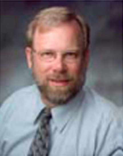
Eric Oberbeck, RG, CEGPrincipal/Senior Engineering Geologist
Eric is Cascadia Geoservices' Principal Senior Engineering Geologist responsible for the Southern Oregon Office located in Curry County, Oregon. Eric has a well-rounded background in engineering and environmental geology and has worked the last twenty-two years primarily within the Coast Range and Siskiyou Mountains of Central and Southern Oregon. He has been involved in all aspects of geologic and geotechnical site evaluations from reconnaissance assessments involving surface mapping to detailed subsurface explorations. He has also developed a working knowledge of environmental assessment and mitigation actions appropriate to the Pacific Northwest.
His work has included geological hazards analysis including landslide investigations, fault and seismic hazards examinations, and coastal bluff and sea cliff erosion and retreat studies. In his spare time, Eric served eight years on the Curry County Planning Commission using his expertise to help guide future development on the Southern Oregon coast.
Eric Oberbeck, RG, CEGPrincipal/Senior Engineering Geologist
Eric is Cascadia Geoservices, Inc. Principal Senior Engineering Geologist responsible for the Southern Oregon Office located in Curry County, Oregon. Eric has a well-rounded background in engineering and environmental geology and has worked the last 22 years primarily within the Coast Range and Siskiyou Mountains of central and southern Oregon. He has been involved in all aspects of geologic and geotechnical site evaluations from reconnaissance assessments involving surface mapping to detailed subsurface explorations. He has also developed a working knowledge of environmental assessment and mitigation actions appropriate to the Pacific Northwest.
His work has included geological hazards analysis including landslide investigations, fault and seismic hazards examinations and coastal bluff and sea cliff erosion and retreat studies. In his spare time, Eric served 8 years on the Curry County Planning Commission using his expertise to help guide future development on the southern Oregon coast.
Education:
B.S., Geology, Sonoma State University, 1979
Graduate Level Study towards MSc., Geology
Colorado School of Mines, 1984
Accreditation:
Registered Oregon Geologist (Oregon)
Certified Engineering Geologist (Oregon)
Rick G. Thrall, PHD, PE, GE Principal / Senior Geotechnical Engineer
Dr. Rick Thrall has over 35 years of geotechnical engineering experience in the Pacific Northwest. Rick has served as a project manager and design engineer on unique combinations of geotechnical and civil engineering projects involving buildings, bridges, dams, landslides, levees, transportation routes, water supply and pumping facilities, park facilities, and pipelines. During that time he has developed an emphasis for successfully tackling projects which are both technically challenging and organizationally difficult.
Rick’s former experience as program manager includes completing engineering studies, developing engineering designs, preparing plans and specifications, and developing cost estimates for multi-discipline Northwest road, bridge, retaining wall and landslide stabilization studies. Rick has completed projects in nearly every western county in Oregon, Washington and Northern California for a variety of public agency and private sector clients. In addition to local State, County and City agencies, Rick’s clients include Architects, Engineers , Homeowners and Contractors.
Education:
Ph. D., Geotechnical Engineering,
Oregon State University, 1981
B.S., Civil Engineering
Oregon State University, 1976
Accreditation:
Professional Engineer (Oregon, Washington)
Geotechnical Engineer (Oregon)
ABOUT OUR LOGO
Our Logo - is a representation of the CASCADIA subduction zone...ocean on the left, volcanoes on the right. Most of us in CASCADIA live between the subduction zone and the volcanoes. The subduction zone generates mega quakes and tsunamis which happen every 300 years or so. It's know as Cascadia and stretches from Northern California to Vancouver Island, Canada.......thus our name........Cascadia Geoservices!
OUR LOGO
Our logo is a representation of the CASCADIA subduction zone—ocean on the left, volcanoes on the right. Most of us in Cascadia live between the subduction zone and the volcanoes. The subduction zone generates mega quakes and tsunamis which happen every 300 years or so. It's known as Cascadia and stretches from Northern California to Vancouver Island, Canada—thus our name—Cascadia Geoservices!
Cascadia, our service area, includes:
- The southern Oregon coast: Subject to intense Pacific Ocean storms driving erosion and relentless bluff retreat
- Coastal Oregon and Washington: Subject to mega earthquakes and tsunamis with unpredictable terrace sand deposits with buried organics and variable groundwater issues
- Cascade Mountains, which are a string of active volcanoes which create unique combinations of basaltic flows and ash deposits
- The Columbia River Basin, which contains the largest river system (by volume of flow) in North America, carved the Columbia Gorge. The Portland, Oregon portion is lined by a large levee system and surrounded by deep molasses-like soil deposits subject to liquefaction and subsidence
- Southern Washington and Northern Oregon: Remnants of the Missoula catastrophic flood deposits, responsible for much of the landslide activity in southwestern Washington
- Northern Washington: Glacially affected deposits
- Oregon and Washington "suspect" terrain consisting of accreted ocean sediments
Every project we encounter contains at least one of the elements of these soils which present a daily challenge. Our long-time local and detailed knowledge allows us to provide efficient solutions when constructing in these conditions.
Cascadia, our service area includes:
- The southern Oregon coast - Subject to intense Pacific Ocean storms driving erosion and relentless bluff retreat
- Coastal Oregon and Washington - Subject to mega earthquakes and tsunamis with unpredictable terrace sand deposits with buried organics and variable groundwater issues
- Cascade Mountains which are a string of active volcanoes which create unique combinations of Basaltic Flows and Ash deposits
- The Columbia River Basin which contains the largest River system (by volume of flow) in North America, Carved the Columbia Gorge. The Portland, Oregon portion is lined by a large levee system and surrounded by deep molasses-like soil deposits subject to liquefaction and subsidence
- Southern Washington and Northern Oregon - Remnants of the Missoula catastrophic flood deposits, responsible for much of the landslide activity in SW Washington
- Northern Washington - Glacially affected Deposits
- Oregon and Washington "Suspect" Terrain consisting of accreted ocean sediments
Every project we encounter contains at least one of the elements of these soils which present a daily challenge. Our long time local and detailed knowledge allows us to provide efficient solutions when constructing in these conditions.